While writing, Trials of War, I got the opportunity of a lifetime to work as an advisor for Florentine Films on The American Revolution. My job was to help them create nearly 100 maps that appear throughout the six-episode series. I really enjoyed that experience, and I thank PBS, Florentine Films, Ken Burns, Sarah Botstein, David Schmidt, Mike Welt, Grace Bartosh, and the many others for the chance to work with them.
My role was mostly the research behind the maps, verifying each place, region, road, path, and so on. I did that using ArcGIS, and I admit it took several thousand hours, most of which were spent before Florentine Films found me.
Once I began working with Florentine Films, I expanded the historical GIS of Colonial America I’d been developing, from the places Isaac Frye traveled during the American Revolution, to include the rest of the North American continent. During the last year or so of production, I created a web map for the graphics team at Phea.TV and the researchers at Florentine Films to check my work and verify their work. I reworked the styling of that map from the high-contrast look that made checking for errors easier to one that hopefully most people will appreciate exploring.
Click here to explore the online map of Colonial North America.
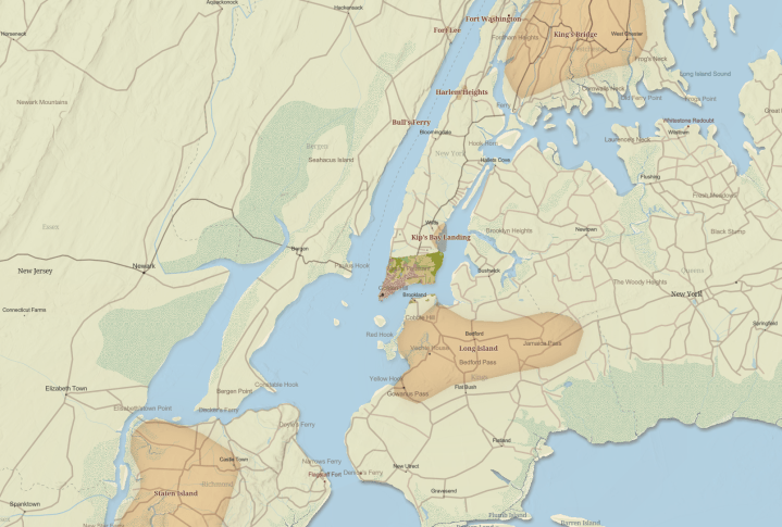
This excerpt shows just some of the territory that New York City occupies today.
The map includes a collection of layers that depict where the European colonists lived, but also where the North American Indian tribes lived in 1775 and 1607.
For anyone who is already an ArcGIS user, I’ve shared the web map and all of the layers in the Colonial North America Layers and Maps group in my ArcGIS Online Home Use account. The data, layers, and maps are free to use under a CC BY 4.0 SA license.
You can learn more about how we created the maps in the series by watching the LinkedIn Live stream video, The Maps Behind the American Revolution, where I, Mike Welt, and Grace Bartosh tell the story of how we made them.
-CEF

