One thing I learned is that because I located my ancestor, I could likely locate every American who likely fought. Use the search box to enter the surname, and if needed, the first name of any American who fought in the battle.
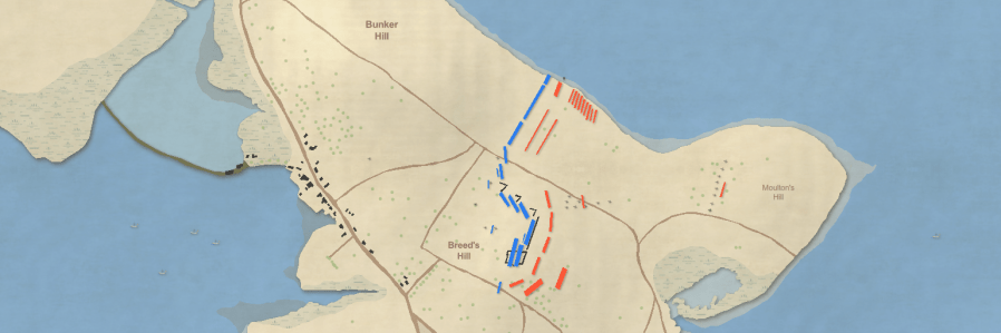
Battle of Breed’s Hill Patriot Locator Map