A recent posting on the George Washington's Mount Vernon site, Committees of Correspondence, got me thinking about how much I've depended on the records of such committees for my research.

A recent posting on the George Washington's Mount Vernon site, Committees of Correspondence, got me thinking about how much I've depended on the records of such committees for my research.
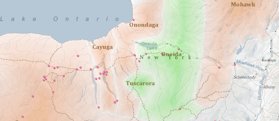
In an earlier post, I described using Geographic Information Systems (GIS) to facilitate my research to trace Isaac Frye's path through the American Revolutionary War. Occasionally using GIS produced more than just a map; it produced new historical insight. One such instance occurred while researching Sullivan's Expedition, or as it is sometimes called, the Iroquois…
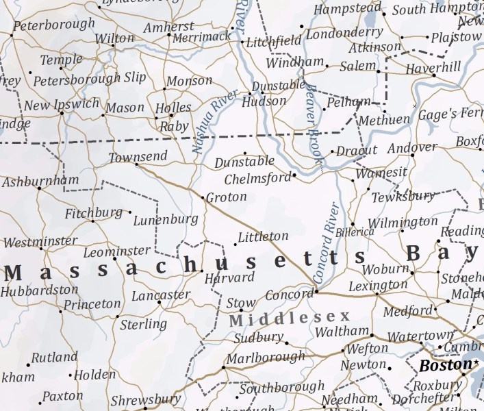
When I started learning about Isaac Frye, one my earliest goals was to put a pencil on the map, so to speak, and trace where he went during the American Revolution. Geographic Information Systems software, commonly called GIS, turned out to be the perfect solution.
In The War has Begun, I include transcripts from the two letters my family has preserved. One is from Isaac to his wife, Elizabeth, in 1775, and the other from Elizabeth late in 1776. I spent hours thinking about the story between the lines of these letters, and am grateful my cousin found these in the attic of Isaac's house in the 1990s. Fast forward to this past Monday evening. I was having dinner in North Hampton with my uncle and cousin, celebrating getting the book published. My uncle asked to get scans of the two letters so he could share with others in the family. Last night we learned the steamer trunk where the two letters were found also had five more documents!
